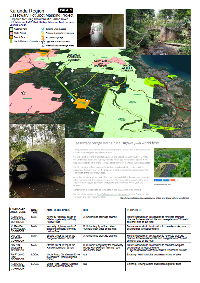
Kuranda Region Cassowary Hot Spot Mapping Project
The Kuranda Region forms the critical “bottleneck” of the Wet Tropics World Heritage Area. In Kuranda the Kennedy Highway cuts the bioregion in half from east to west and has inhibited the passage of terrestrial species through deforestation and local roads.
Care and planning can accommodate the land uses for humans (roads, infrastructure) and cassowaries (fragmented essential habitats) to produce World Class results in safety for humans and wildlife who use these crossing zones.
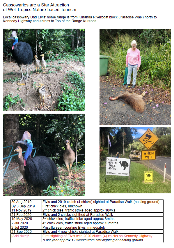
The following documents have been prepared to illustrate the local knowledge of cassowaries, their habits and areas of intersection (crossing zones) with potentially lethal hazards such as roads like the Kennedy Highway.
These document set has been prepared for:
TO: Craig Crawford MP Barron River
CC: Minister TMR Mark Bailey, Minister Environment Leanne Enoch


