DATE: 2 February 2018
LETTER TO MINISTER RE: Intervention regarding controversial planning decisions made by Mareeba Shire Council
Is Mareeba Shire Council flaunting planning rules?
cc Minister for Local Government, Mareeba Shire Council and State planners
Dear Minister
We already wrote to the last Minister about this last year but we believe the timing was such, that it overlapped with the caretaker mode due to the State elections.
We are asking for your intervention regarding controversial planning decisions made by Mareeba Shire Council.
Councillors have on several occasions approved planning applications for subdivisions against the planners recommendation and despite lot sizes being too small to comply with the rural zoning of both the superseded MSC 2004 planning scheme and the new MSC 2016 planning scheme.
In the 15 June 2016 Council meeting, Council requested that Council officers progress an investigation into a potential rural precinct area centred around Koah Road and to encompass all land within Preferred Area No 3 – Clohesy River Area of the Mareeba Shire Planning Scheme 2004, and report back to Council “with a recommendation on the preferred minimum lot size for the rural zone in this area.”
It is to be noted that the Preferred Area No 3 – Clohesy River Area of the Mareeba Shire Planning Scheme 2004 had been discarded since it was in conflict with the FNQ 2031 regional plan.
However Council had not made any advances into the investigation till it was finally decided in the 25 Oct 2017 Council meeting:
“That Council authorize the Chief Executive Office to seek fee proposals from suitably qualified planning consultants to undertake a planning study into a potential rural precinct area centered around Koah Road, encompassing all land within Preferred Area No 3 – Clohesy River Area of the Mareeba Shire Planning Scheme 2004, including a recommendation on the preferred minimum lot size for the rural zone in this area.”
We understand changing the new MSC 2016 planning scheme in that way would require State approval and public consultation.
Instead of following proper procedure Councillors have used the intention to investigate a “Preferred Area No 3 – Clohesy River Area” as a reason to allow subdivisions in that area despite lots being too small to comply with the zoning of both the superseded MSC 2004 planning scheme and the new MSC 2016 plan.
This was the case in all three development applications below:
Item 6 in the 19 July 2017 MSC meeting, the development application M & G CASEY RECONFIGURING A LOT-SUBDIVISION (1 INTO 2 LOTS)-LOT 201 ON RP843530-182 KANERVO ROAD, KOAH-DA/17/0022, was sent back to the planners to come up with conditions for approval. It subsequently was approved in the Council Meeting 16 August 2017.
Item 1 Council meeting 12 October 2016 PJ GIBBS – RECONFIGURING A LOT – SUBDIVISION (1 INTO 4 LOTS) LOT 17 SP219912 – 244 KANERVO ROAD, KOAH – DA/15/0045 was sent back to the planners to come up with conditions for approval. It subsequently was approved in the Council Meeting 16 November 2016.
Item 1 Council meeting 16 November 2016 M MCKEEN – RECONFIGURING A LOT – SUBDIVISION (1 INTO 2 LOTS) LOT 1 SP154474 – 25 COPLAND ROAD, KOAH – DA/16/0033 was sent back to the planners to come up with conditions for approval. It subsequently was approved in the Council Meeting 21 December 2016.
Not following proper process involved in changing a planning scheme is depriving the community of their rights.
We feel community consultation regarding the changing of minimum rural lot size in the Koah area is especially important considering the following;
– Above safe levels of arsenic have been found in supposedly potable bore water in rural residential subdivisions in Koah.
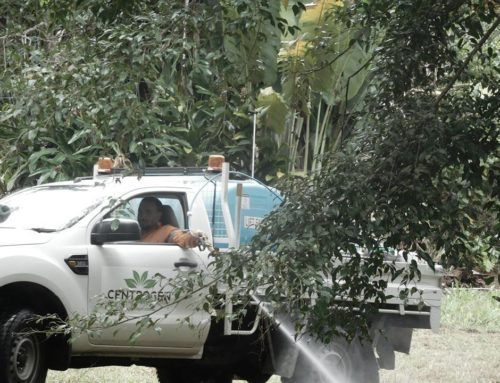
– Existing agricultural businesses with high intensity land use lay within the area. As no buffer zones are in place residents may be affected by dangerous spray drift.
– Matters of local environmental significance have not yet been included in the MSC 2016 plan. As a result the area is still missing important habitat linkages which could lead to fragmentation. The surrounding remnant ecotone vegetation is particularly high in biodiversity.
– End of last year and beginning of this year saw Koah ravaged by bushfires. Much of the land lies in bushfire hazard area medium, high and very high. Increasing the population in the Koah area may further burden emergency services.
We ask for your help and look forward to hearing your opinion on this matter.
Yours
Nadine O’Brien
Sarah Isaacs
Jo Martin
Syd Walker
Maree Kerr
for KRPG