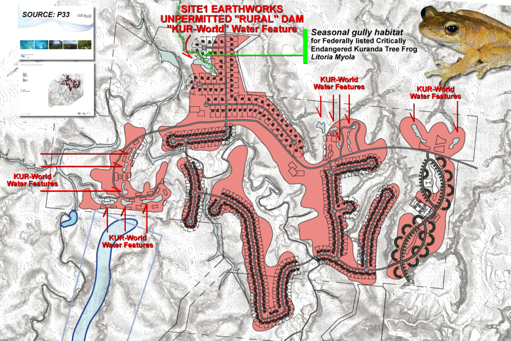
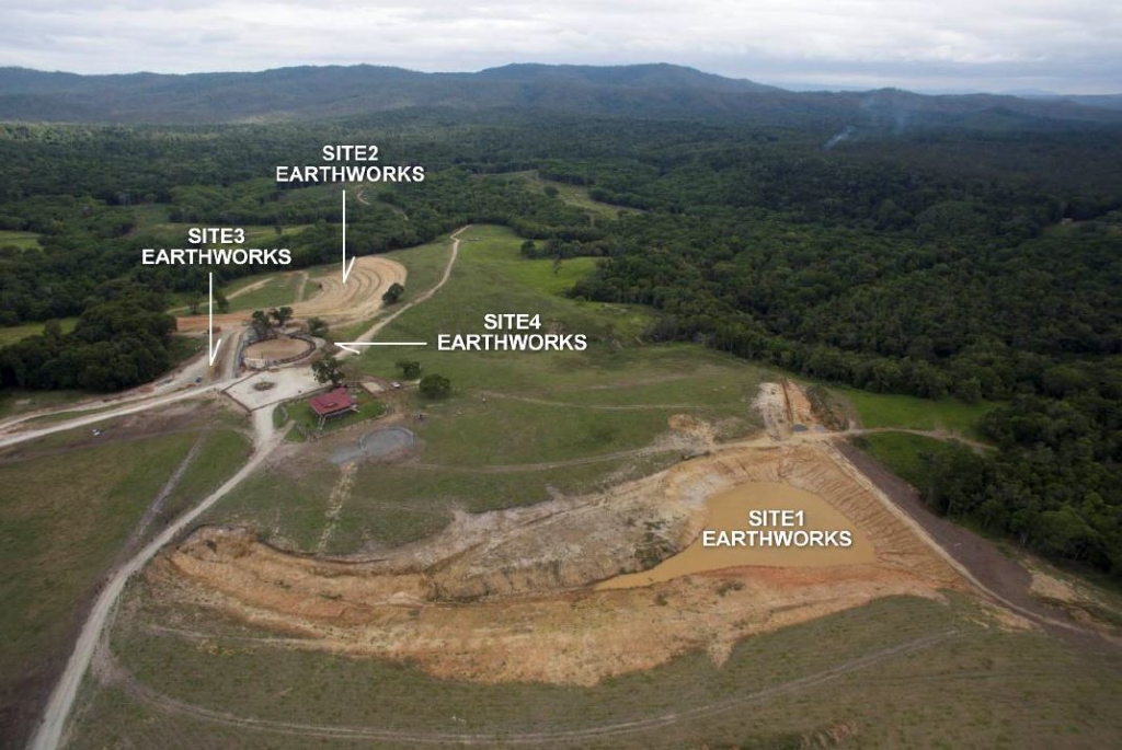
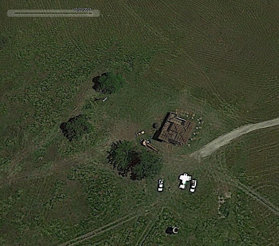
SITE1 EARTHWORKS
SITE1 EARTHWORKS is positioned on the KUR-World Master Plan as a water feature on the LIFESTYLE VILLAS precinct. The blue peanut shaped water feature is marked just below the original seasonal gully – breeding habitat of the Federally protected, Critically Endangered Kuranda Tree Frog Litoria Myola.
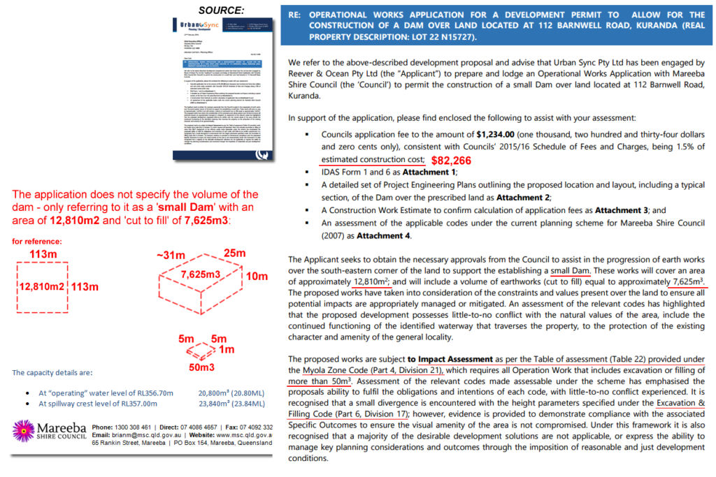
The dam’s final position is not below, as on the KUR-World Master Plan, but ON the seasonal gully. The dam has undergone three (3) engineer designs as the original earthworks was ‘cut by eye’ without a permitted and approved dam design. Not following proper process has resulted in the necessary Soil and Erosion Plans not being developed for the site at the actual time of the operational works.
IMAGES: Click for larger version
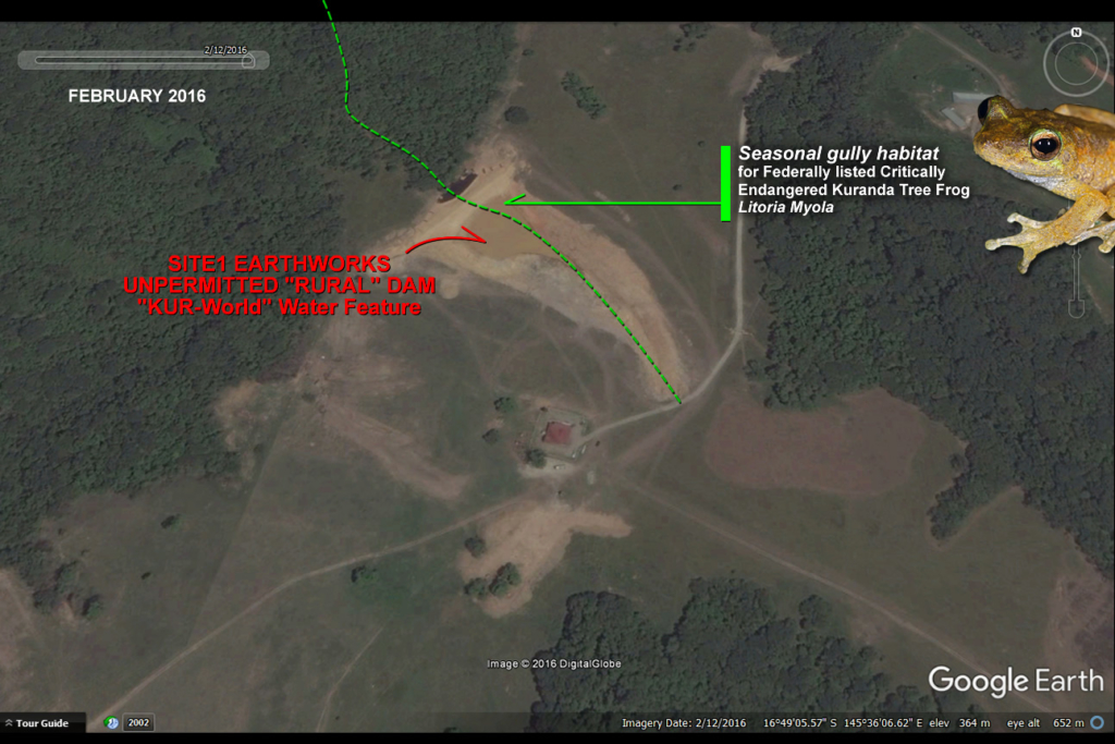
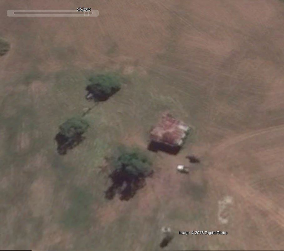
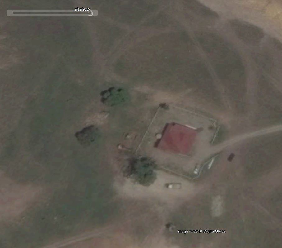
SITE1 EARTHWORKS dam is first visible on Google Earth February 2016. In December 2015 adjoining residents to the BARNWELL property reporting machine noise to Mareeba Shire Council brought an inspector to the site in the same month. Council ordered a ‘Stop Work’ and requested the developer supply a Operational Works Permit Application for the site. At 7,625m3 ‘cut to fill’ this represents 150 x the minimum size (50m3) requiring a permit.
Stuart Ricketts, Urban Sync Pty Ltd prepared the OPERATIONAL WORKS APPLICATION FOR A DEVELOPMENT PERMIT for the dam on behalf of the developer, Ken Lee, Reever and Ocean Pty Ltd and submitted to council in February 2016.
As Ken Lee didn’t have a ‘lawfully established grazing operation‘ legal entity there was a delay of five months while the developer re-oriented to becoming one ‘on paper‘.
2015 DECEMBER Full extent of land clearing up to 200ha visible on Google Earth
2015 DECEMBER Dam completed on property – stop work ordered by Mareeba Shire Council after community reports
2015 DECEMBER Ministerial Diary Curtis Pitt MP – Meeting with Harry Sou and Ken Lee of Reever and Ocean Pty Ltd
2016 FEBRUARY Dam and Site2, Site3 Earthworks appear on Google Earth for the first time
2016 FEBRUARY Retrospective Dam application submitted to council
2016 MARCH Road closure request submitted on KUR-World proposed site
2016 APRIL Mareeba Shire Council approves road closure on KUR-World proposed site (following month)
2016 APRIL KUR-WORLD.COM domain name is purchased by Ken Lee’s Australian company Reever and Ocean Pty Ltd
EPBC doc notes unpublished report by Hoskin, C., 2016
2016 APRIL Dr Conrad Hoskins second report published
2016 MAY Ken Lee registers Australian company Reever and Ocean Developments Pty Ltd
2016 MAY KUR-COW.COM domain name purchased by Ken Lee’s Australian company Reever and Ocean Pty Ltd
2016 MAY EPBC Referral of proposed action for ‘KUR-World’ submitted by Reever & Ocean Developments Pty Ltd
KUR-Cow‘ lawfully established grazing operations’ not accounted for on master plan footprint
2016 MAY Initial Advice Statement (IAS) submitted by Reever & Ocean Developments Pty Ltd
2016 JULY KUR-World proposal is declared a State Coordinated Project
Why would a ‘lawfully established grazing operation’ be a State Coordinated Project?
2016 JULY 3rd Cairns Post article, first mention of ‘KUR-Cow’ 17 July
2016 JULY Retrospective dam approval by Mareeba Shire Council 20 July
2016 JULY KUR-Cow Pty Ltd, KUR-Cow Research Pty Ltd registered 28 July
IMAGES: Click for larger versions

SITE1 EARTHWORKS dam was subject to Impact Assessment under the following codes:
- Myola Zone Code (Part 4, Division 21)
- Excavation & Filling Code (Part 6, Division 17)
IMAGE BELOW: Click for larger excerpt version
SOURCE: Op-Works-Appliation-OW160001.pdf
SUSTAINABLE PLANNING ACT 2009 – CH 7
578 Carrying out assessable development without permit
(1) A person must not carry out assessable development unless there is an effective development permit for the development.
Maximum penalty—1665 penalty units.
(2) Subsection (1)—
(a) applies subject to subdivision 2; and
(b) does not apply to development carried out under section 342(3).
(3) Despite subsection (1), the maximum penalty is 17000 penalty units if the assessable development is on a Queensland heritage place or local heritage place.
The penalty unit value in Queensland is $121.90 (current from 1 July 2016).
EARTHWORKS SITE1: FINE FOR BREACH
1,665 x 121.90 = $202,963.50
LETTER: Reporting Earthworks Activity Barnwell to Mareeba Shire Council 9 Dec 16
SITE2 EARTHWORKS
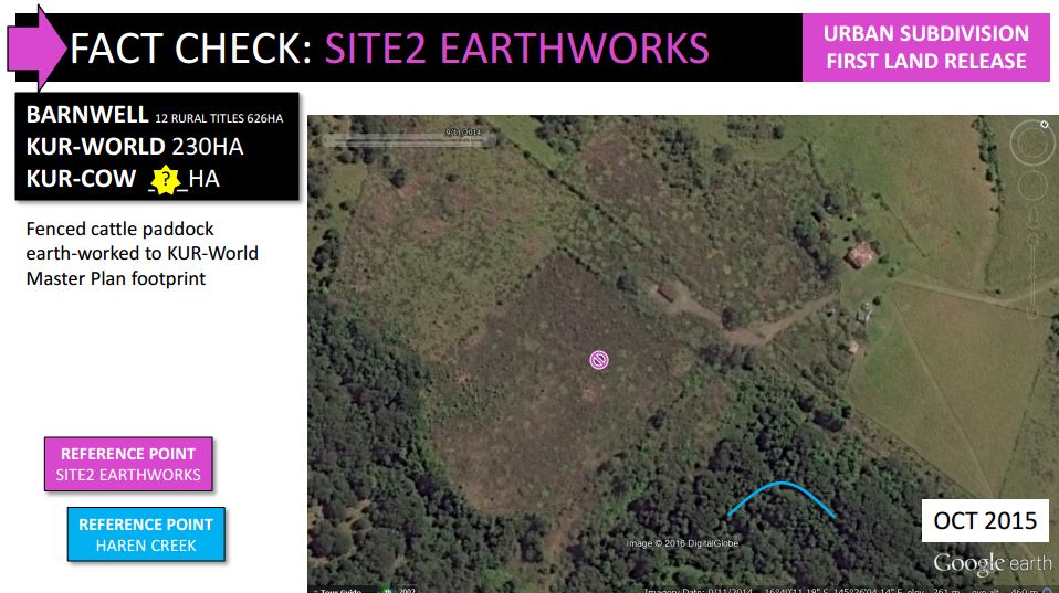
SITE2 EARTHWORKS
This area of the property was a large fenced cattle paddock as can be seen from earlier Google Earth images. The unpermitted earthworks for this part of the KUR-World Master Plan started after Feb 2016 and was mostly completed by July 2016, as visible from aerial images.
The land preparation for the first urban residential land release 600m2 lines up on the KUR-World Master Plan. These major earthworks are upslope of Haren Creek where downstream habitat can be found for two Federally protected frog species.
Inadequate soil and erosion controls in place at time of earthworks, discernible from aerials. Two newly cut sediment pits were documented at the bottom of the site – cut only a week ahead of the developer’s EHP inspection on 17 August 2016.
IMAGES: Click for larger version

SITE2 EARTHWORKS was subject to Impact Assessment under the following codes:
- Myola Zone Code (Part 4, Division 21)
- Excavation & Filling Code (Part 6, Division 17)
ie. “which requires all Operation Work that includes excavation or filling of more than 50m3.”
SUSTAINABLE PLANNING ACT 2009 – CH 7
578 Carrying out assessable development without permit
(1) A person must not carry out assessable development unless there is an effective development permit for the development.
Maximum penalty—1665 penalty units.
(2) Subsection (1)—
(a) applies subject to subdivision 2; and
(b) does not apply to development carried out under section 342(3).
(3) Despite subsection (1), the maximum penalty is 17000 penalty units if the assessable development is on a Queensland heritage place or local heritage place.
The penalty unit value in Queensland is $121.90 (current from 1 July 2016).
EARTHWORKS SITE2: FINE FOR BREACH
1,665 x 121.90 = $202,963.50
LETTER: Reporting Earthworks Activity Barnwell to Mareeba Shire Council 9 Dec 16
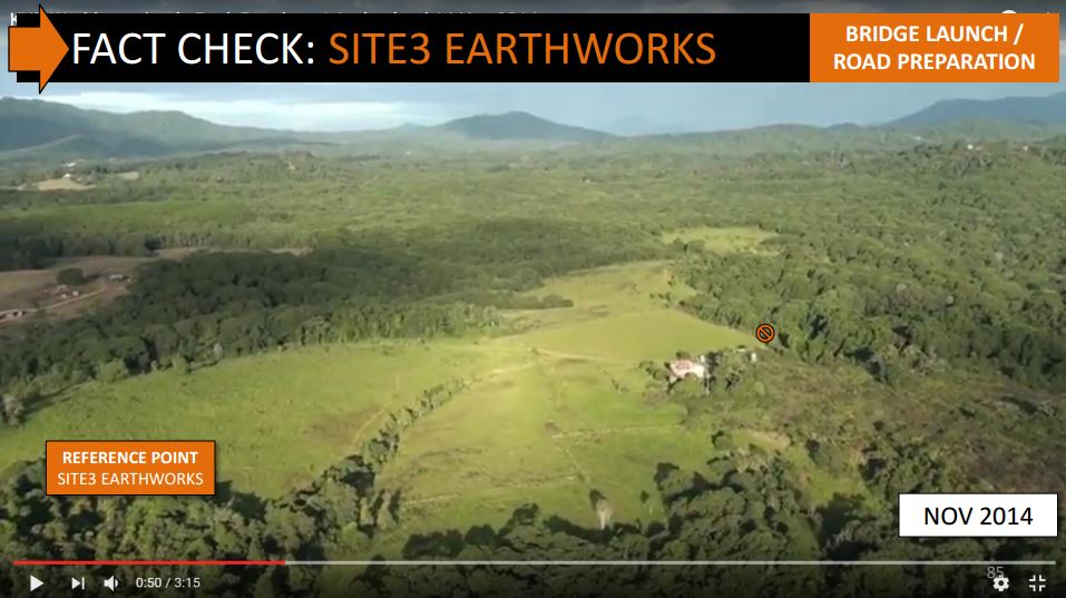
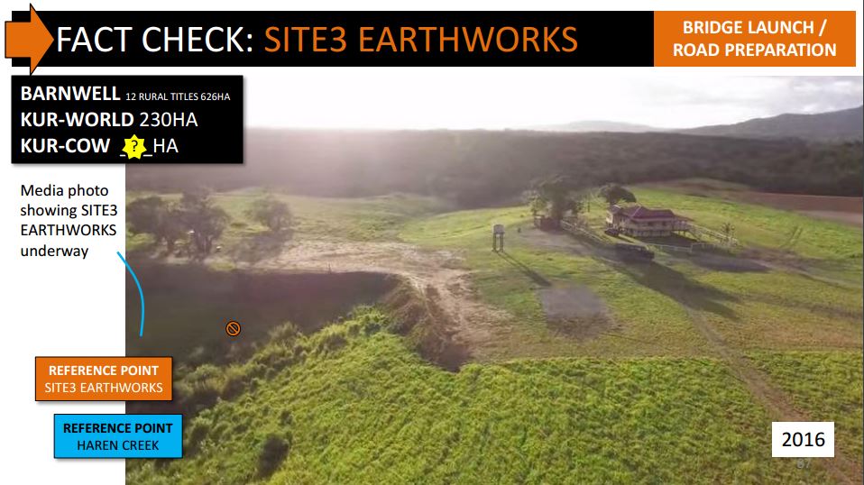
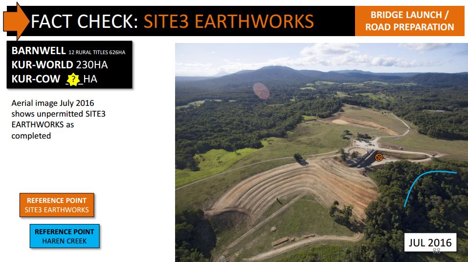
SITE3 EARTHWORKS
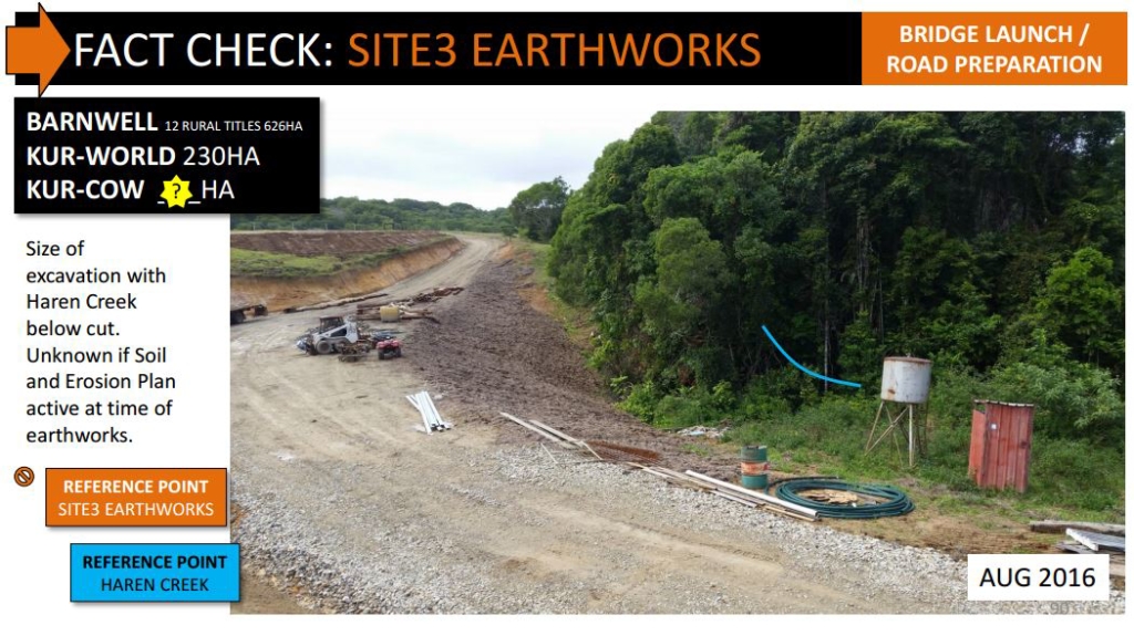
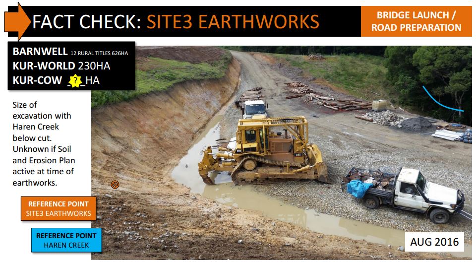
The early photo of homestead shows SITE3 EARTHWORKS in the foreground and the dam back right. SITE3 looks to be filled with cut from the dam. Further excavations under the fill into natural ground can be seen in the catchment above Haren Creek, upstream of Federally protected frog habitat.
Unknown if any Soil and Erosion Plan was designed and implemented on this site.
A substantial cut and fill above Haren Creek if not correctly engineered, as per the dam, may result in extensive damage if the mass is lost in a rain event.
Unknown if any remediation is required on SITE3.
IMAGES: Click for larger version

SITE3 EARTHWORKS was subject to Impact Assessment under the following codes:
- Myola Zone Code (Part 4, Division 21)
- Excavation & Filling Code (Part 6, Division 17)
ie. “which requires all Operation Work that includes excavation or filling of more than 50m3.”
SUSTAINABLE PLANNING ACT 2009 – CH 7
578 Carrying out assessable development without permit
(1) A person must not carry out assessable development unless there is an effective development permit for the development.
Maximum penalty—1665 penalty units.
(2) Subsection (1)—
(a) applies subject to subdivision 2; and
(b) does not apply to development carried out under section 342(3).
(3) Despite subsection (1), the maximum penalty is 17000 penalty units if the assessable development is on a Queensland heritage place or local heritage place.
The penalty unit value in Queensland is $121.90 (current from 1 July 2016).
EARTHWORKS SITE3: FINE FOR BREACH
1,665 x 121.90 = $202,963.50
LETTER: Reporting Earthworks Activity Barnwell to Mareeba Shire Council 9 Dec 16
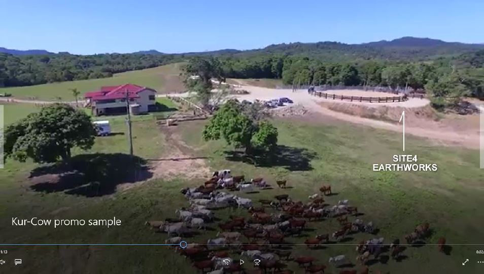
SITE4 EARTHWORKS
SITE4 EARTHWORKS cattle infrastructure was not present on the property as of February 2016. Aerial photos July 2016 show the cattle yard.
IMAGES: Click for larger version
SITE4 EARTHWORKS was subject to Impact Assessment under the following codes:
- Myola Zone Code (Part 4, Division 21)
- Excavation & Filling Code (Part 6, Division 17)
ie. “which requires all Operation Work that includes excavation or filling of more than 50m3.”
SUSTAINABLE PLANNING ACT 2009 – CH 7
578 Carrying out assessable development without permit
(1) A person must not carry out assessable development unless there is an effective development permit for the development.
Maximum penalty—1665 penalty units.
(2) Subsection (1)—
(a) applies subject to subdivision 2; and
(b) does not apply to development carried out under section 342(3).
(3) Despite subsection (1), the maximum penalty is 17000 penalty units if the assessable development is on a Queensland heritage place or local heritage place.
The penalty unit value in Queensland is $121.90 (current from 1 July 2016).
SITE4 EARTHWORKS: FINE FOR BREACH
1,665 x 121.90 = $202,963.50
LETTER: Reporting Earthworks Activity Barnwell to Mareeba Shire Council 9 Dec 16
EXTENSIVE RENOVATION OF ORIGINAL HOMESTEAD
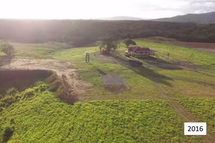
The old dilapidated historic homestead (BARNWELL FAMILY HOMESITE – circa 1927) was radically improved and modified including a lifting of the structure and restumping, re-roofing, new external 350 degree decking on hi-set building, external stairways, new cladding and linings.
IMAGES: Click for larger version
HOMESTEAD RENOVATION was subject to Assessable development under the following codes:
238 Assessable development
- A development permit is necessary for assessable development.
Note—
It is an offence to carry out assessable development without a development permit. See section 578 (Carrying out assessable development without permit).
Cairns Post: Sydney businessman plans for new eco-tourism venture at Kuranda

SUSTAINABLE PLANNING ACT 2009 – CH 7
578 Carrying out assessable development without permit
(1) A person must not carry out assessable development unless there is an effective development permit for the development.
Maximum penalty—1665 penalty units.
(2) Subsection (1)—
(a) applies subject to subdivision 2; and
(b) does not apply to development carried out under section 342(3).
(3) Despite subsection (1), the maximum penalty is 17000 penalty units if the assessable development is on a Queensland heritage place or local heritage place.
The penalty unit value in Queensland is $121.90 (current from 1 July 2016).
HOMESTEAD RENOVATION: FINE FOR BREACH
1,665 x 121.90 = $202,963.50
LETTER: Reporting the BARNWELL homestead renovations to Mareeba Shire Council 13 Feb 2017
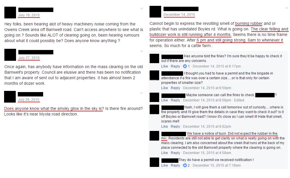
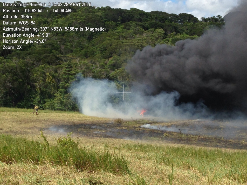
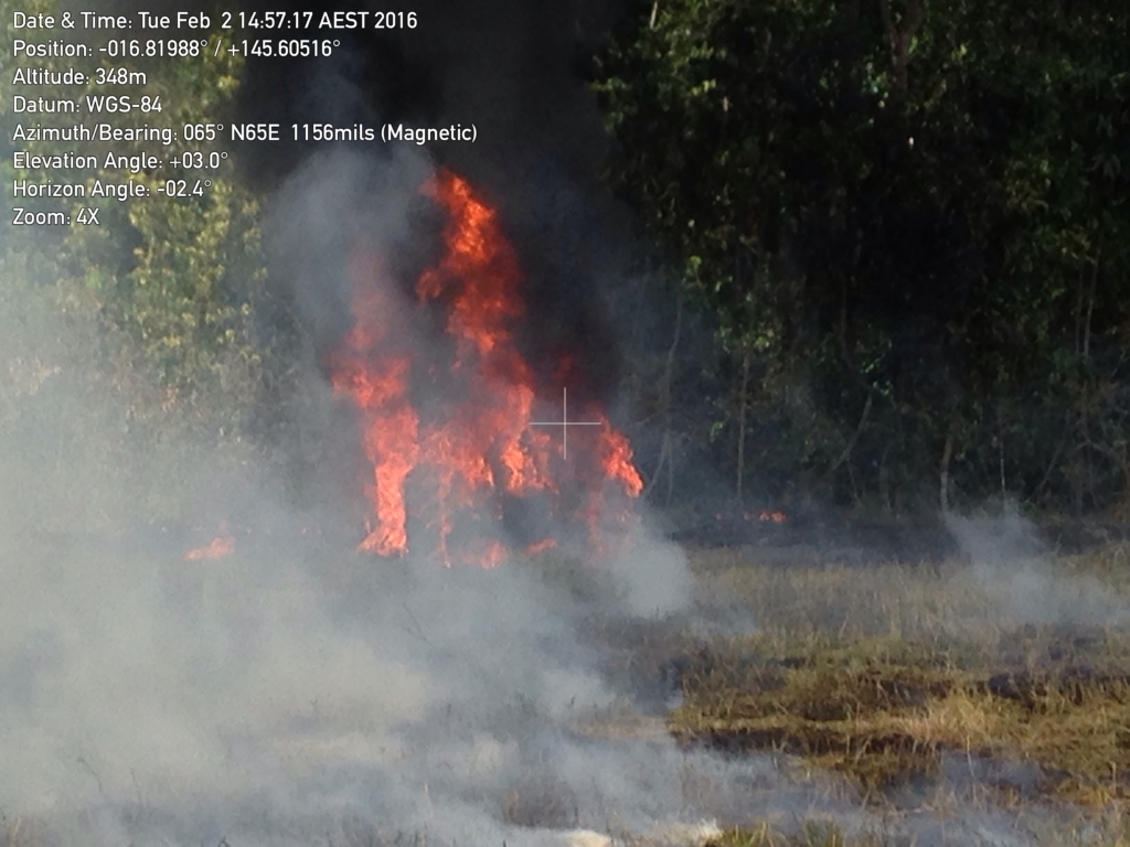
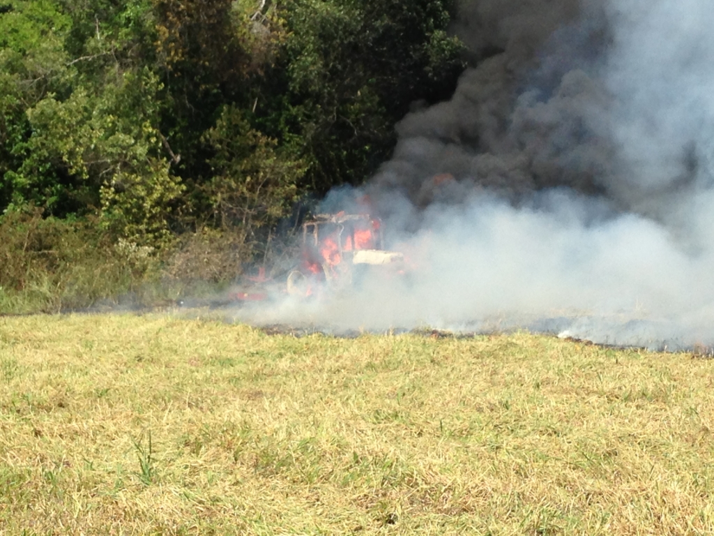
WIND ROW FIRE ACTIVITY
Multiple reports from adjoining residents indicate a lot of material was burned.
There are two reports of ‘burning rubber’ – one explained by the tractor fire in FEB 2016
* Permits requested from Rural Fire Service 23 Dec 16
Rural Fire Service provided confirmation of the following permits on BARNWELL 30 JAN 2017:
- 11 DEC 2015 – 11 JAN 2016
- 19 JAN 2016 – 19 FEB 2016
* Fires reported by community appear to be within the permitted dates.
IMAGES: Click for larger version
Fire Information
The Fire and Rescue Service Act 1990 is the principal legislation that deals with lighting fires in the open in Queensland. The Fire and Rescue Service Act 1990 makes it illegal to light a fire without a ‘Permit to Light Fire’ issued by a fire warden.
You must not light a fire if :
- More than 2m, without a permit from the QFRSA
Lighting a fire that is subject to a prohibition or restriction may result in the issue of a $569 fine
Council Officers may issue a $569 fine to the person responsible for lighting the fire or alternatively to the property owner.
SOURCE: Lighting Fires Fact Sheet.pdf
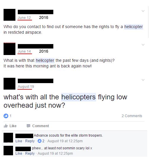
HELICOPTER ACTIVITY
FORM CONFIRMATION FROM https://complaints.bksv.com/asa
Thank you. We have received your submission.
REPLY: airservices-noise-complaints-and-information-service-case-no-6329-kuranda